Screen D — Recent Night Aurora Mosaic (Northern + Southern Hemisphere)
Summary
This is a stitched mosaic of auroral brightness from recent nighttime satellite passes, shown for both hemispheres. It is not a single instant. Think of it as: “Where did the aurora show up during the most recent night?”
More detail
What “mosaic” means (important!)
- This image is built from multiple polar satellite passes collected over time (in near real-time) and stitched together.
- That’s why it can look patchy: different areas were observed at different moments or with different spacecraft.
- The polar orbiting NOAA-21, Suomi and NOAA-20 spacecraft are used to collect this information in cooperation with NESDIS and JPSS. It is, to our knowledge at the present time, the only source of near real-time space-based auroral activity information that is publicly available.
Northern and Southern Hemisphere panels
- Each hemisphere is shown in a circular polar projection so you can see the overall oval “ring” where aurora tends to appear (the auroral oval).
- Brighter regions generally indicate stronger auroral emission during the polar passes included in the mosaic. It takes about 12 to 14 hours of prior polar passes to form one complete hemispheric mosaic.
Colored guide lines: darkness vs sunlight
- The red line represents where the sun is rising or setting at the time of the last polar pass.
- The blue line represents astronomical darkness, where the sun is 18 degrees below the horizon, or where the moon is rising or setting. During the course of a month, the blue line will trace out a wedge feature that depends on when the moon rises or sets. The moon can inhibit observations of auroral activity.
- The dotted yellow line represents the location of the most recent polar pass of data. You can use it to help determine which patch of imagery is related to the most recent data.
- The time of the last satellite polar pass is indicated after the "->" (bottom left block of text, the middle line).
- Data is updated in near real-time, but since it takes 90 minutes for one spacecraft to orbit, the data for a particular region can take time to be covered. That is why this is not a snapshot in time. There are currently no spacecraft capable of providing such snapshots.
- The next spacecraft polar pass is indicated on the bottom line of the bottom-left block of text. These times are all Universal Time (England time). Use Google to convert from UTC to your local time.
- You generally need darkness (and clear skies) to see aurora from the ground.
- These overlays help you interpret whether aurora could have been visible to observers on the ground during the time window covered.
- During the polar summer, there is no darkness and so no auroral activity can be viewed from the spacecraft. This is why polar summers cause a black hole to appear over the poles, where no auroral activity imagery is possible. That area of no-data does not mean auroral activity won't be observed in the imagery. The auroral oval expands equatorward during disturbed conditions, so even during the polar summer, disturbed conditions will produce visible areas of auroral activity in darkness.
If you like DETAIL: Solar Terrestrial Dispatch produces extremely detailed (less than 1 km per pixel) summaries of these 24-hour peak activity mosaic's, available here. They're fun to look at because they also show the city lights that were active on that day. Cloudy areas will blur city lights. Be aware, however, that these images are HUGE (more than 16,000 pixels square) and will require close to 100 megabytes to download.
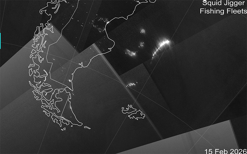
In the detailed high-resolution images (above), you can often find ocean lights from fishing fleets. For example, the movements of squid jigger fleets off the eastern coast of South America can often be found.